Ritika NarangUrban Designer

About me

Ritika Narang smiling outdoors in a tan vest

Hi, I'm Ritika

I'm an urban designer, urban planner and placemaker. I design master plans, corridors, neighbourhoods, streets and public spaces. I care about people-friendly streets and a public realm that works for everyone regardless of socioeconomic status, and about multimodal transportation. I believe design should leave a positive mark on the climate — I'm a climate-sensitive design advocate. My decisions are shaped by big-picture data analysis grounded in grassroots understanding. I'm also an aspiring AI generalist, learning how AI can make urban design workflows faster and testing where it can genuinely help solve the problems cities face.

Five years of experience in urban design in the United States and architectural design in India. Interests span master planning, transit-oriented development, climate-responsive design, street design, and placemaking. Holds a Master of Urban Design from Carnegie Mellon University (2023) and a Bachelor of Architecture from NMIMS Balwant Sheth School of Architecture (2019). Committed to creating a positive impact on the built environment and the climate through thoughtful, people-centered design.

Experience

Jan 2025 – Jun 2026

Urban Designer II

Toole Design Group

Atlanta, GA

  • Trail alignment and street design for a multimodal connection, supporting research to improve pedestrian and bicyclist safety, comfort and accessibility.
  • Complete Streets design for a neighbourhood corridor, sketching in community studios and producing corridor axonometrics, street montages and a hand-drawn concept to improve multimodal access and public space.
  • Street typology design for four neighbourhood types, translating written safety recommendations into drawings a city engineer can price and build.
  • Riverfront corridor planning, testing a regional trail alignment against site conditions across connectivity, ecology and cultural resources.

Jul 2023 – Oct 2024

Urban Designer

Chattanooga Design Studio

Chattanooga, TN

  • Mixed-income residential masterplanning, drawing the capacity test-fit plan, unit-type diagrams and massing that balance density with connectivity and equity.
  • Civic district revitalization planning, coordinating mapping, community engagement and urban design research on the client side for a downtown vision plan.
  • Mixed-use district masterplanning, drawing the site plan, massing diagrams and greenway circulation network that balance heritage preservation with new development.
  • Organised Parking Day, turning on-street parking spaces into temporary public rooms with seating, plants and activities to spark conversation about how streets can serve people.

2022

Urban Design Internships

Principal Group and Speck & Associates (2 day contract basis)

Boston, MA and Carmel, IN

  • Master planning support, including yield calculations, base maps, 3D site models and massing studies.
  • Hand-drafted plan studies and design concepts grounded in walkability principles.

Sep 2021 – Dec 2022

Research Assistant

Remaking Cities Institute, Carnegie Mellon

Pittsburgh, PA

  • GIS mapping and analysis for a township boulevard study.

Scales of urban design practice

Master planning

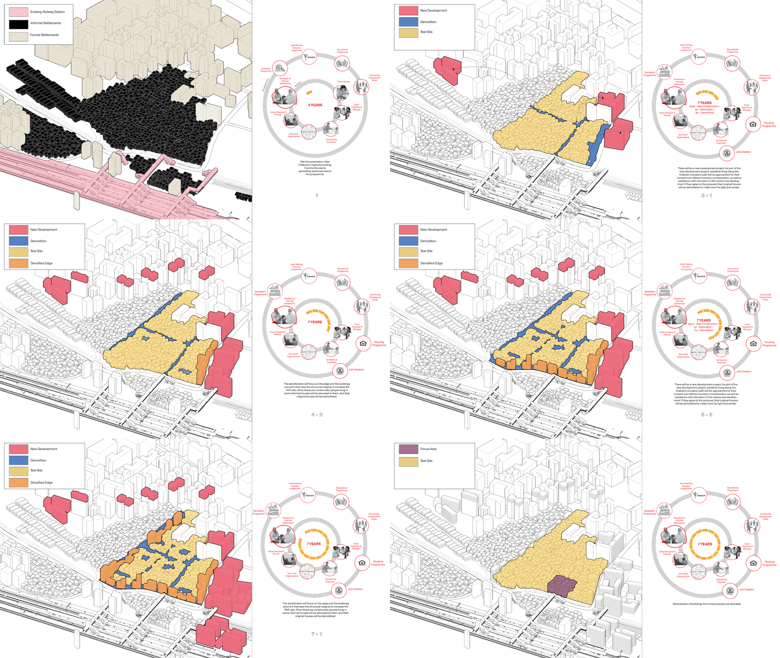
Neighbourhood and district-scale plans that balance density, heritage, ecology and public space.
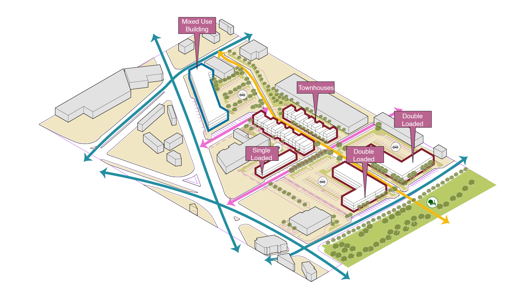
Master plan drawing showing blocks, open space and movement network
Animated master plan sequence showing settlement mapping and a phased programme

Street and Corridor Design

Multimodal streets, trail alignments and complete-street concepts drawn for safety, comfort and access.
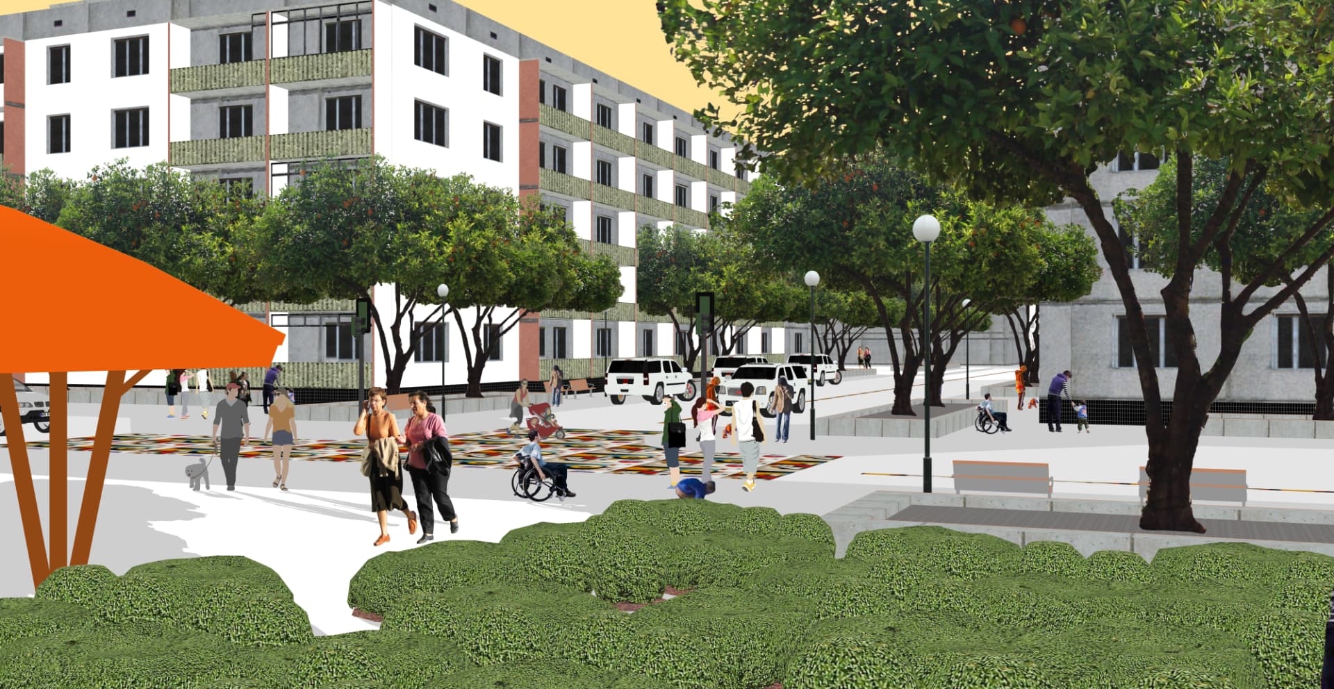
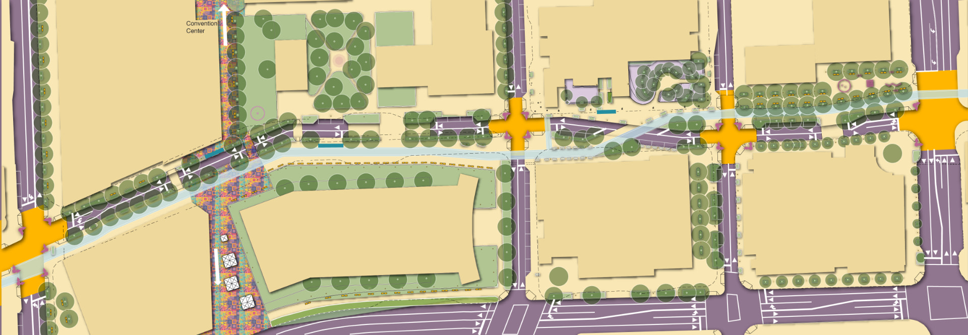
Street-level view of a shaded, people-first plaza and sidewalk
Colour street plan showing sidewalks, planting, crossings and travel lanes

Place making

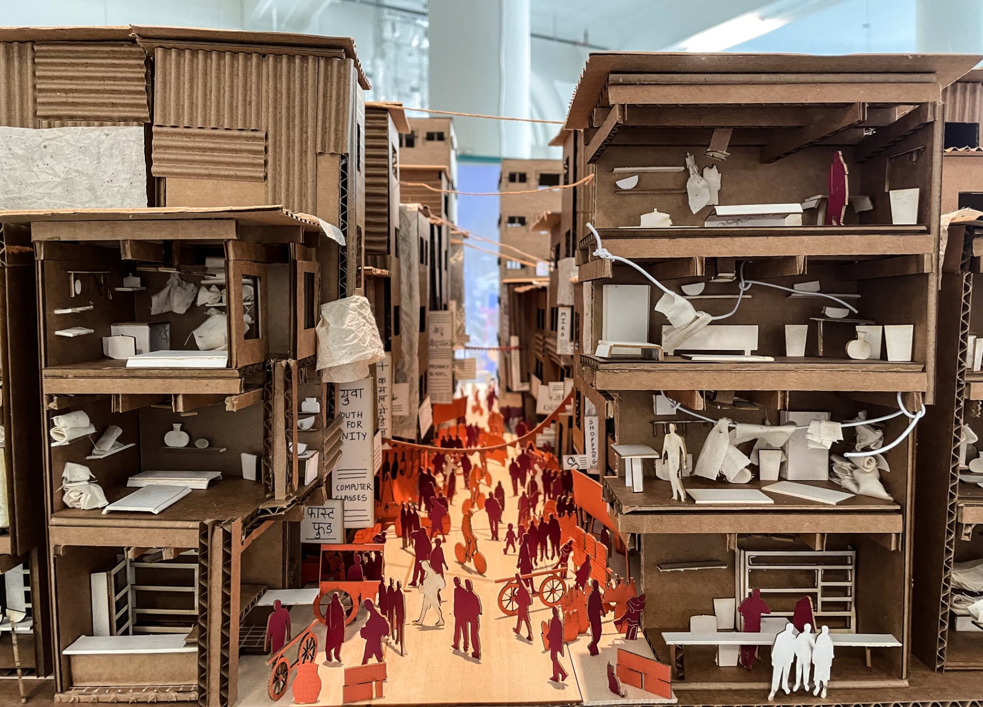
Temporary and permanent interventions that turn spaces into lively and people-first places.
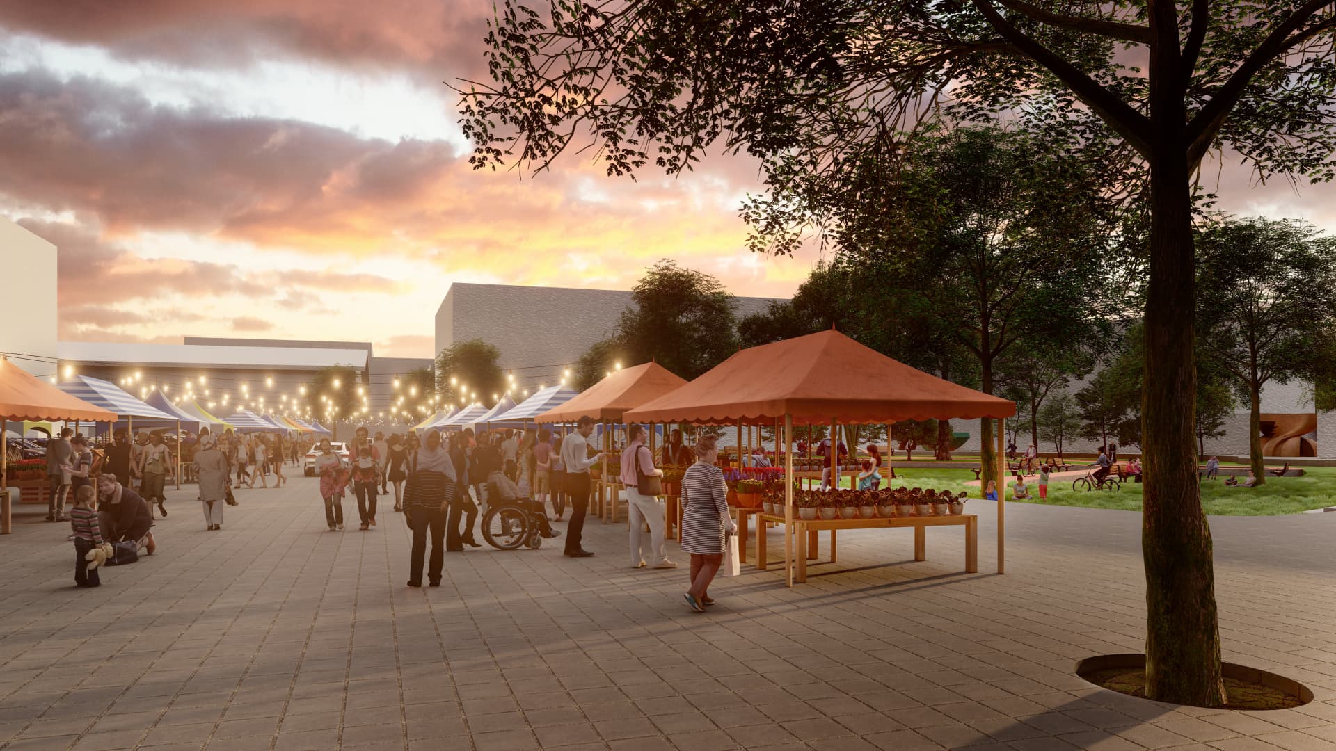
Evening market on a public plaza with stalls, string lights and people
Cardboard sectional model of a dense market street with cut-out figures

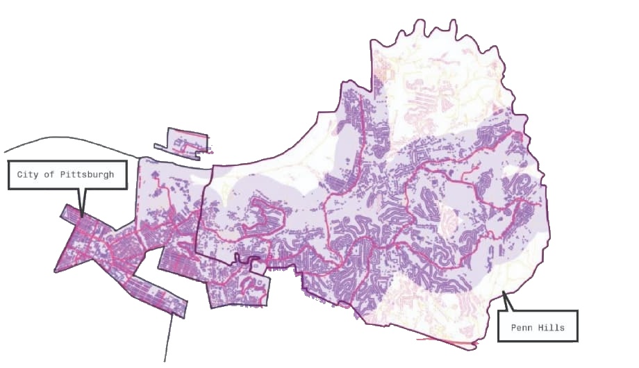
GIS mapping

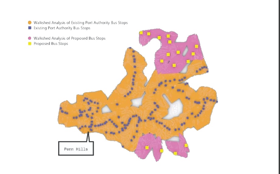
Spatial analysis of transit access, population density and walkshed coverage used to test and propose network change.
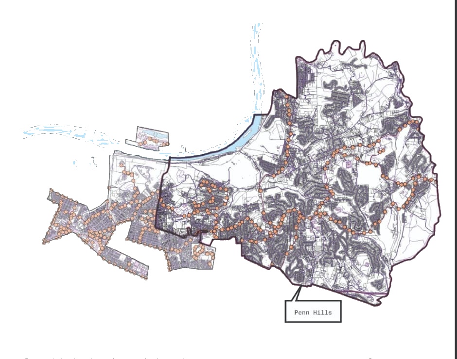
Existing Port Authority bus stop locations across Penn Hills
Walkshed analysis showing a 0.6 mile buffer from bus routes
Walkshed analysis comparing existing and proposed bus routes
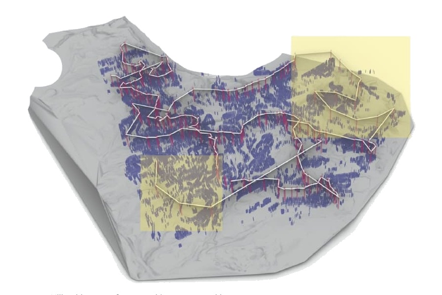
Three dimensional terrain model with proposed bus routes and stops

Skills

Design & Planning

  • Master planning
  • Transit-oriented development
  • Street design
  • Placemaking
  • Multimodal planning
  • Climate-responsive design
  • Capacity testing

Research & Analysis

  • ArcGIS
  • BearGIS
  • DecodingSpaces
  • Elefront
  • Street audits

Engagement

  • Community engagement
  • Client coordination
  • Public charrettes
  • Presentations

BIM & 3D

  • Rhinoceros
  • Revit
  • Grasshopper
  • Vectorworks
  • SketchUp
  • AutoCAD

Presentation & Rendering

  • Photoshop
  • Illustrator
  • InDesign
  • Procreate
  • After Effects
  • V-Ray
  • Lumion
  • Twinmotion
  • Enscape

The making

  • Model making
  • Laser cutting
  • Sketching
  • 3D printing